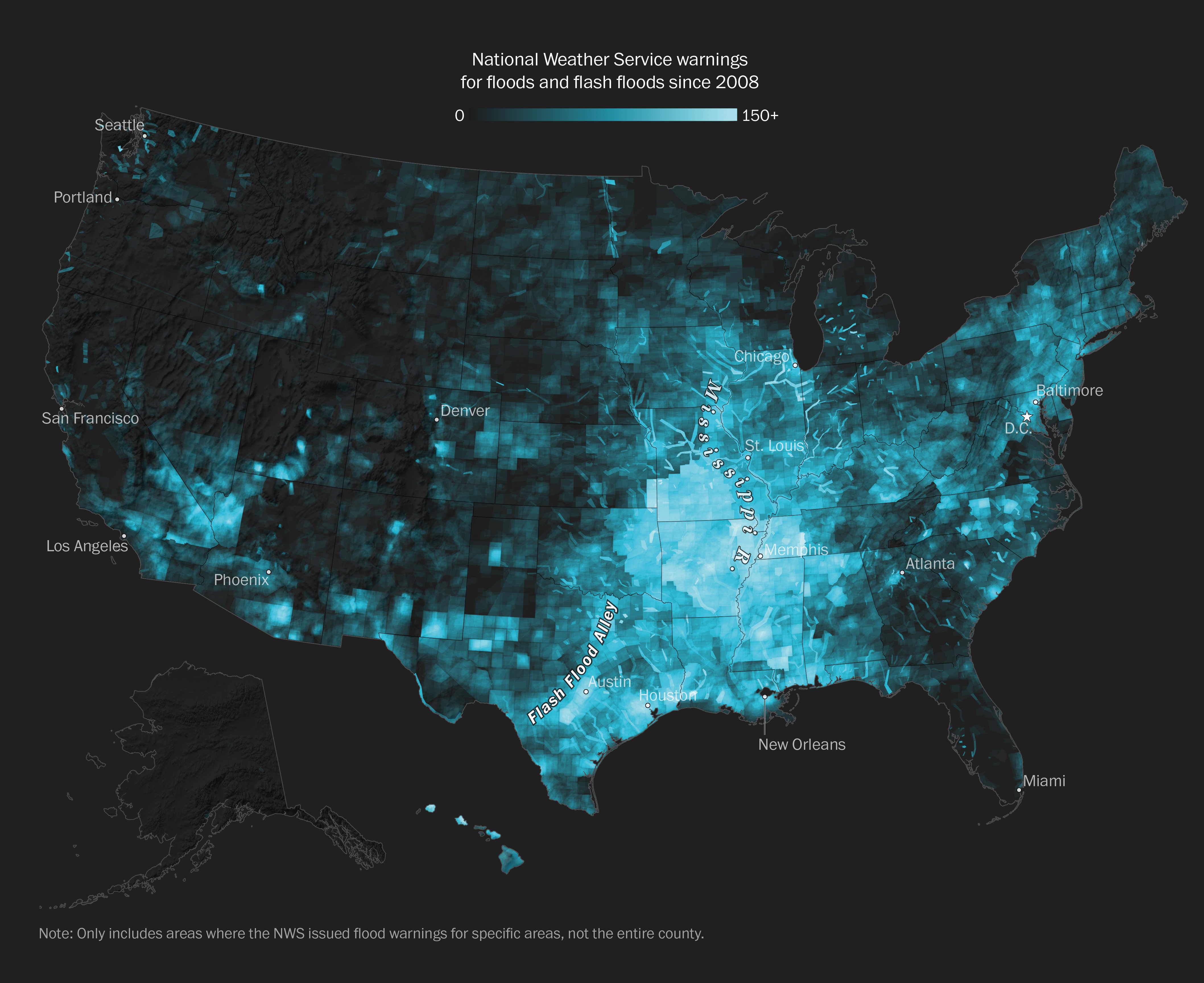
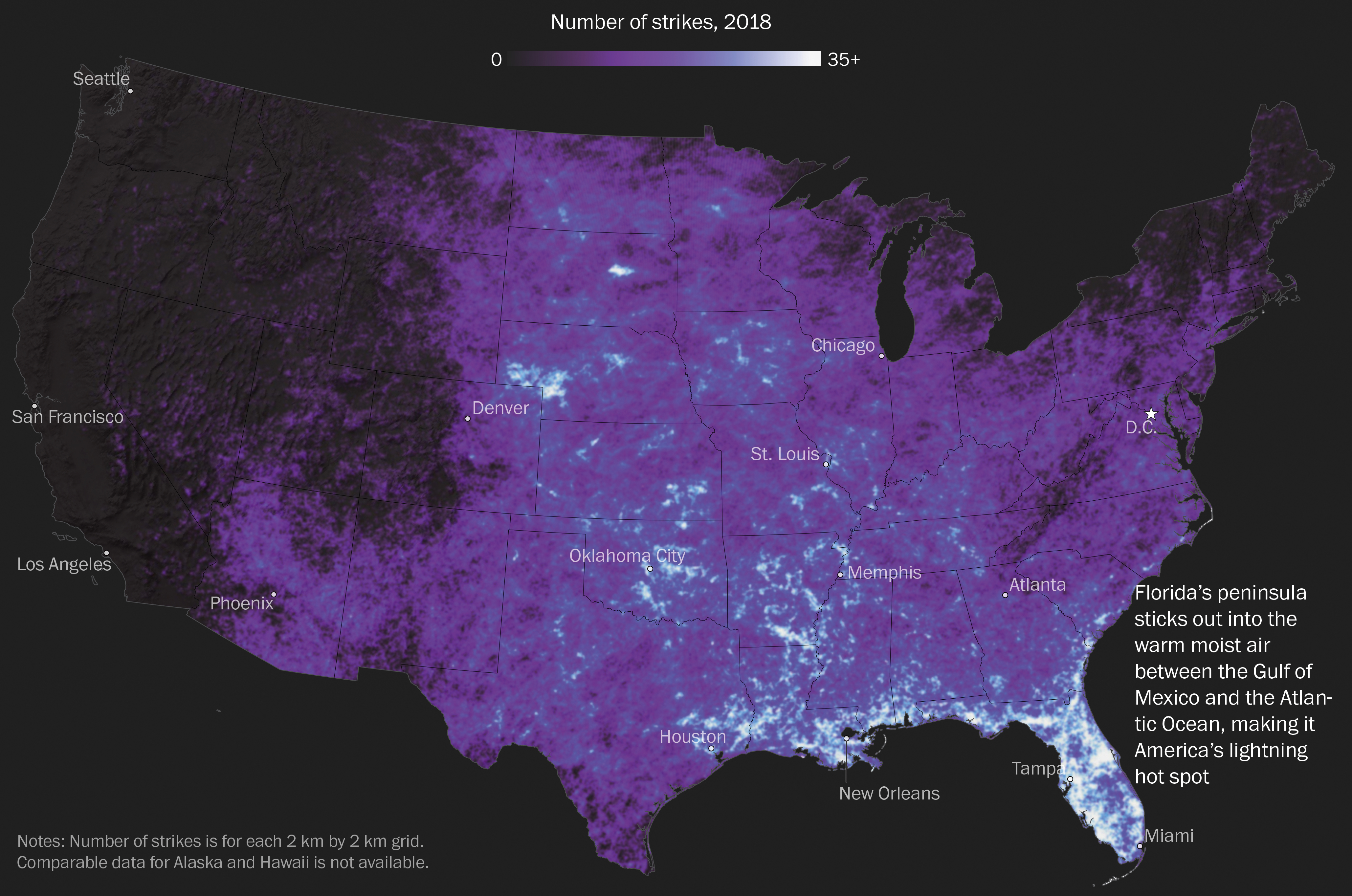
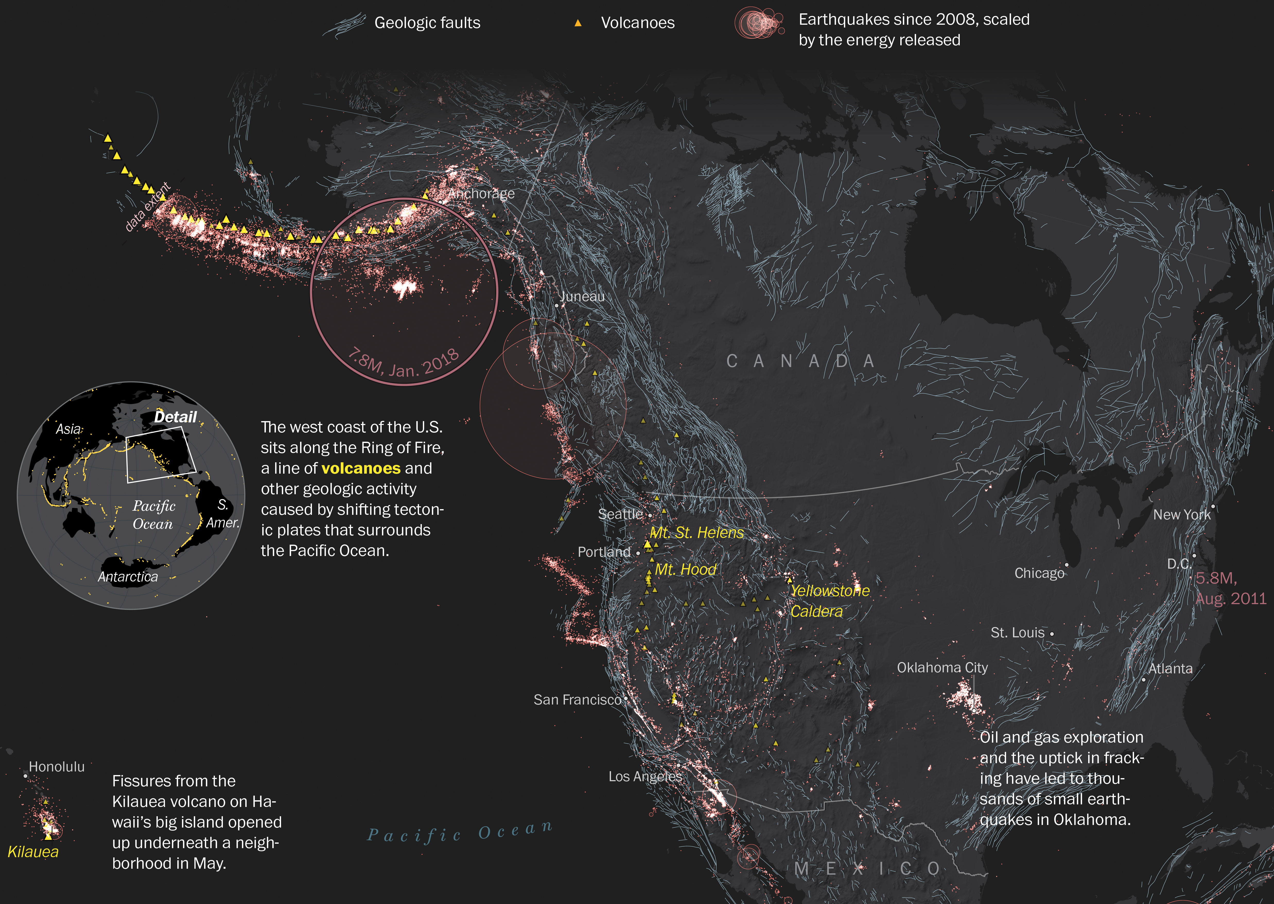
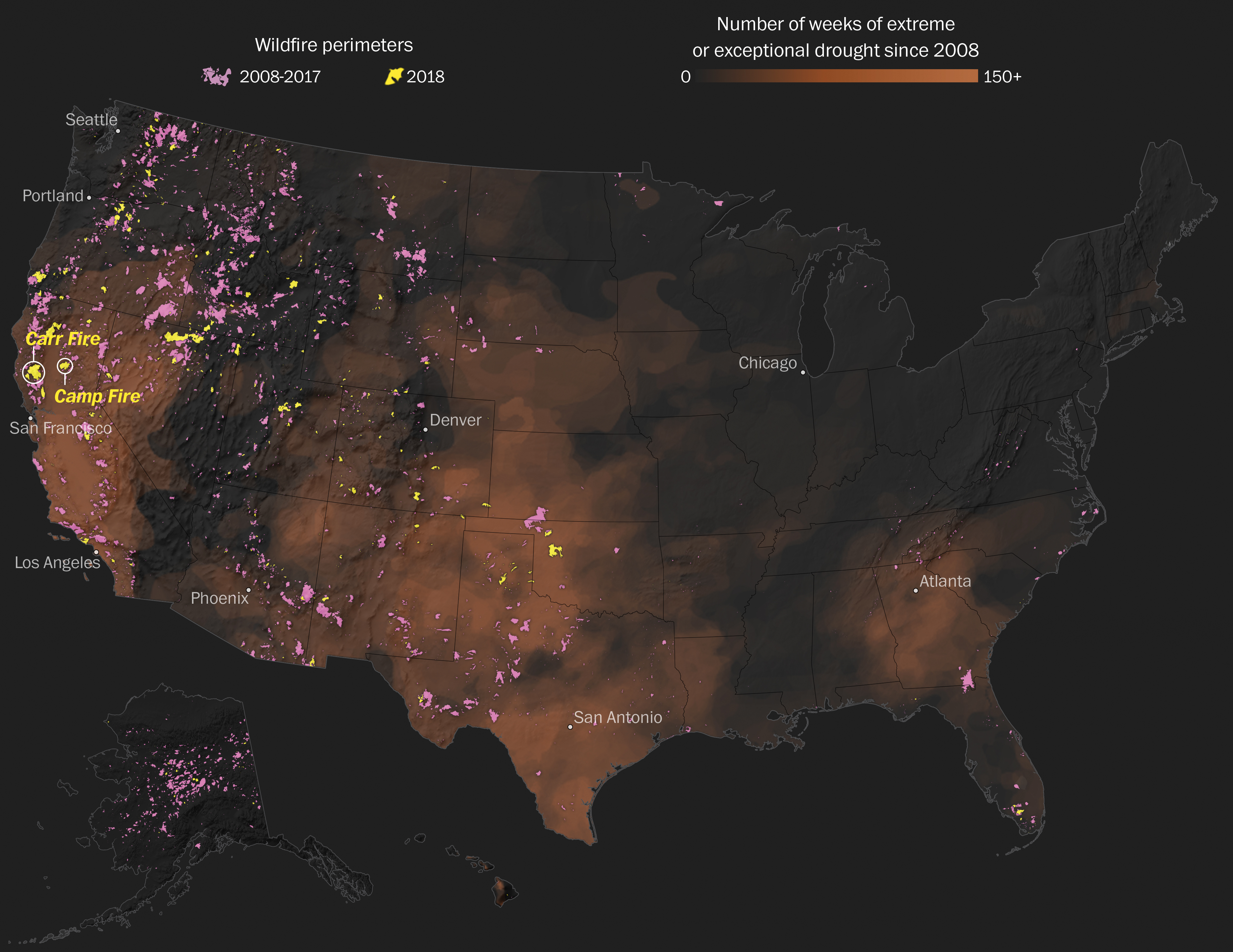
America's wicked weather and natural disasters
View project →
Published: April 25, 2019 | The Washington Post
A striking map series showing that no region of the U.S. is immune to natural disaster. The visuals highlight the national footprint of risk, grounded in rigorous data and minimal cartographic design.
Role: Lead author, cartographer, and visual editor
Highlights:
- Authored, designed, and visualized the entire series, crafting a unified narrative across disaster types
- Created six distinctive maps, each reflecting the nature of specific hazards—from floods to fires
- Employed minimal, data-driven cartography to emphasize patterns without visual noise
- Reinforced the idea that risk is shared, even if its form varies regionally